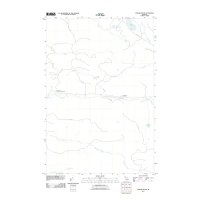
2011 Map of Northland NW
USGS Topo · Published 2011About this map
The West Branch Escanaba River and North Branch Ford River carve through this Upper Peninsula landscape, defining the topography of West Branch Township. This 2011 survey reveals a region dedicated to forestry and recreation, centered around the West Branch State Forest Campground and Lower Dam Campground. Water is the dominant feature, from the oddly named Lake Thirtysix to the connected systems of Kates Lake and Little Kates Lake.
Find a feature on this map
25 named features on this map. Tap any name to fly to it.
Don’t see what you’re looking for? This feature index may not catch every label — zoom into the map to look around manually.
Map Details
Editions of this 2011 Northland NW Map
This is the sole edition of this map. No revisions or reprints were ever made.
Other maps of this area

1952 · Ishpeming
USGS Topo · 1:62,500

1955 · Ralph NE
USGS Topo · 1:24,000

1955 · Republic
USGS Topo · 1:62,500

1955 · Ralph
USGS Topo · 1:62,500

1957 · Northland
USGS Topo · 1:62,500

1958 · Marquette
USGS Topo · 1:250,000

1960 · Marquette
USGS Topo · 1:250,000

1961 · Marquette
USGS Topo · 1:250,000

1968 · Marquette
USGS Topo · 1:250,000
1983 · Gwinn
USGS Topo · 1:100,000