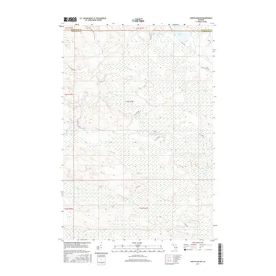
2017 Map of Northland NW
USGS Topo · Published 2017About this map
The W Br Escanaba River and N Br Ford River flow through this section of the Upper Peninsula, marking a landscape defined by significant wetlands and isolated glacial lakes. Located along the border of Marquette and Dickinson counties, the area is characterized by its hydrological network, including Kates Lake, Little Kates Lake, and the uniquely named Lake Thirtysix.
Find a feature on this map
33 named features on this map. Tap any name to fly to it.
Don’t see what you’re looking for? This feature index may not catch every label — zoom into the map to look around manually.
Map Details
Editions of this 2017 Northland NW Map
This is the sole edition of this map. No revisions or reprints were ever made.
Other maps of this area

1952 · Ishpeming
USGS Topo · 1:62,500

1955 · Ralph NE
USGS Topo · 1:24,000

1955 · Republic
USGS Topo · 1:62,500

1955 · Ralph
USGS Topo · 1:62,500

1957 · Northland
USGS Topo · 1:62,500

1958 · Marquette
USGS Topo · 1:250,000

1960 · Marquette
USGS Topo · 1:250,000

1961 · Marquette
USGS Topo · 1:250,000

1968 · Marquette
USGS Topo · 1:250,000
1983 · Gwinn
USGS Topo · 1:100,000