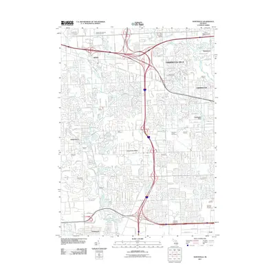
2011 Map of Northville
USGS Topo · Published 2011About this map
Novi, Farmington Hills, and Northville anchor this map of a densely developed suburban landscape at the edge of the Detroit metropolitan area. The region is defined by its intricate network of numbered roads, including W 12 Mile Rd and 5 Mile Rd, and the major thoroughfare of Grand River Ave. Numerous historic cemeteries, such as Yerkes Cemetery and Rural Hill Cemetery, are preserved among the modern residential subdivisions and commercial corridors. The hydrology is dominated by the Middle River Rouge and several reservoirs like Phoenix Lake and Wilcox Lake. This survey illustrates the mature suburban sprawl of the early 21st century, where large-scale institutions like Madonna University and Wayne State University Oakland Center stand alongside established recreational sites such as Northville Downs and the Independence Green Golf Course.
Find a feature on this map
53 named features on this map. Tap any name to fly to it.
Don’t see what you’re looking for? This feature index may not catch every label — zoom into the map to look around manually.
Map Details
Editions of this 2011 Northville Map
This is the sole edition of this map. No revisions or reprints were ever made.
Other maps of this area

1902 · South Lyon
USGS Topo · 1:62,500

1904 · Ann Arbor
USGS Topo · 1:125,000

1905 · Wayne
USGS Topo · 1:62,500

1906 · South Lyon
USGS Topo · 1:62,500

1907 · Pontiac
USGS Topo · 1:62,500

1908 · Ann Arbor
USGS Topo · 1:125,000

1909 · Milford
USGS Topo · 1:62,500

1912 · Wayne
USGS Topo · 1:62,500

1936 · Inkster
USGS Topo · 1:31,680

1936 · Wayne
USGS Topo · 1:31,680