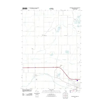
2011 Map of Northwest Albion
USGS Topo · Published 2011About this map
Rice Creek and the riverfront village of Marengo anchor this agricultural landscape in eastern Calhoun County. The map details a transition from the rolling glacial topography in the north, punctuated by water bodies like Bell Lake, Silvers Lake, and Prairie Lake, to the flatter floodplains of the Kalamazoo River in the south. The rectilinear road grid, defined by names such as 24 Mile Rd and L Dr N, connects scattered farmsteads and numerous small burial grounds including Rice Creek Cemetery and Krenerick Cemetery. This 2011 survey captures the area's rural character as modern infrastructure, like the interstate highway, intersects the traditional movement patterns along W Michigan Ave. The presence of several family-named landmarks like Dyer Cemetery and Sampson Cemetery offers valuable touchpoints for genealogists tracing the local lineage of these central Michigan townships.
Find a feature on this map
57 named features on this map. Tap any name to fly to it.
Don’t see what you’re looking for? This feature index may not catch every label — zoom into the map to look around manually.
Map Details
Editions of this 2011 Northwest Albion Map
This is the sole edition of this map. No revisions or reprints were ever made.
Other maps of this area

1919 · Springport
USGS Topo · 1:62,500

1921 · Springport
USGS Topo · 1:62,500

1921 · Marshall
USGS Topo · 1:62,500

1923 · Marshall
USGS Topo · 1:62,500

1943 · Marshall
USGS Topo · 1:62,500

1948 · Spring Arbor
USGS Topo · 1:62,500

1948 · Homer
USGS Topo · 1:62,500

1949 · Homer
USGS Topo · 1:62,500

1949 · Spring Arbor
USGS Topo · 1:62,500

1958 · Grand Rapids
USGS Topo · 1:250,000