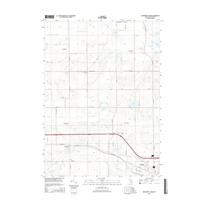
2014 Map of Northwest Albion
USGS Topo · Published 2014About this map
The Kalamazoo River winds through the southern portion of this landscape, anchoring a region defined by its complex hydrography and agricultural grid. Just north of the river, the small settlement of Marengo sits along W Michigan Ave, near the Marengo Village Cem. The terrain is remarkably water-rich, featuring a dense concentration of glacial lakes and wetlands including Prairie Lake, Winnipeg Lake, and the curiously named Gang of Lakes in the northeast.
Find a feature on this map
68 named features on this map. Tap any name to fly to it.
Don’t see what you’re looking for? This feature index may not catch every label — zoom into the map to look around manually.
Map Details
Editions of this 2014 Northwest Albion Map
This is the sole edition of this map. No revisions or reprints were ever made.
Other maps of this area

1919 · Springport
USGS Topo · 1:62,500

1921 · Springport
USGS Topo · 1:62,500

1921 · Marshall
USGS Topo · 1:62,500

1923 · Marshall
USGS Topo · 1:62,500

1943 · Marshall
USGS Topo · 1:62,500

1948 · Spring Arbor
USGS Topo · 1:62,500

1948 · Homer
USGS Topo · 1:62,500

1949 · Homer
USGS Topo · 1:62,500

1949 · Spring Arbor
USGS Topo · 1:62,500

1958 · Grand Rapids
USGS Topo · 1:250,000