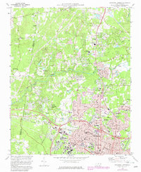
1973 Map of Northwest Durham
USGS Topo · Published 1982About this map
Durham expands northward toward the Eno River during this era of significant institutional and suburban development. The presence of Duke University, Elder VA Hospital, and Watts Hospital underscores the city's role as a major medical and educational hub. Industrial and state infrastructure is visible at the State Prison and the various radio towers, including Radio Tower (WTVD) and Radio Towers (WDNC), while the northern fringes maintain a more rural character with numerous country churches like Mt Sylvan Ch and Cains Chapel Ch.
Find a feature on this map
69 named features on this map. Tap any name to fly to it.
Don’t see what you’re looking for? This feature index may not catch every label — zoom into the map to look around manually.
Map Details
Editions of this 1973 Northwest Durham Map
3 editions found
Other maps of this area

1943 · Durham South
USGS Topo · 1:62,500

1946 · Chapel Hill
USGS Topo · 1:24,000

1947 · Chapel Hill
USGS Topo · 1:31,680

1951 · Durham South
USGS Topo · 1:62,500

1951 · Durham North
USGS Topo · 1:62,500

1953 · Raleigh
USGS Topo · 1:250,000

1953 · Greensboro
USGS Topo · 1:250,000

1954 · Greensboro
USGS Topo · 1:250,000

1954 · Raleigh
USGS Topo · 1:250,000

1962 · Greensboro
USGS Topo · 1:250,000