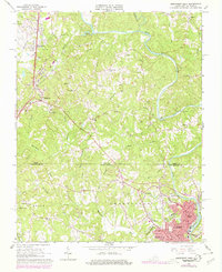
1965 Map of Northwest Eden
USGS Topo · Published 1978About this map
Leaksville and Spray anchor the southeastern corner of this landscape, positioned along the banks of the Smith River and the Southern railway. This late 1960s perspective captures a pivotal moment for these industrial textile centers before their formal consolidation. The map reveals the intricate network of mill-town streets and infrastructure, including the Townhall and local landmarks like Lakeside Sch. Moving north across the Virginia North Carolina state line, the terrain shifts into the rural ridges of Henry County, dominated by features like Sheffield Hill and Drag Mtn.
Find a feature on this map
53 named features on this map. Tap any name to fly to it.
Don’t see what you’re looking for? This feature index may not catch every label — zoom into the map to look around manually.
Map Details
Editions of this 1965 Northwest Eden Map
2 editions found
Other maps of this area

1924 · Martinsville
USGS Topo · 1:48,000

1924 · Draper
USGS Topo · 1:48,000

1926 · Martinsville
USGS Topo · 1:62,500

1926 · Draper
USGS Topo · 1:62,500

1927 · Martinsville
USGS Topo · 1:62,500

1944 · Martinsville
USGS Topo · 1:62,500

1944 · Draper
USGS Topo · 1:62,500

1953 · Greensboro
USGS Topo · 1:250,000

1954 · Greensboro
USGS Topo · 1:250,000

1962 · Greensboro
USGS Topo · 1:250,000