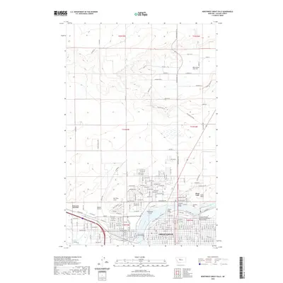
2020 Map of Northwest Great Falls
USGS Topo · Published 2020About this map
The confluence of the Missouri River and the Sun River anchors this study of the northwestern reaches of Great Falls. The landscape is defined by the industrial and transport history of the region, specifically at Smelter Hill and the prominent Black Eagle Indian Butte. The rail infrastructure is clearly documented, including the Chicago Milwaukee Saint Paul and Pacific Railroad Bridge spanning the river near the urban core.
Find a feature on this map
46 named features on this map. Tap any name to fly to it.
Don’t see what you’re looking for? This feature index may not catch every label — zoom into the map to look around manually.
Map Details
Editions of this 2020 Northwest Great Falls Map
This is the sole edition of this map. No revisions or reprints were ever made.
Other maps of this area

1886 · Great Falls
USGS Topo · 1:250,000

1948 · Portage
USGS Topo · 1:62,500

1949 · Portage
USGS Topo · 1:62,500

1949 · Great Falls
USGS Topo · 1:62,500

1951 · Great Falls
USGS Topo · 1:62,500

1954 · Great Falls
USGS Topo · 1:250,000

1955 · Stockett
USGS Topo · 1:62,500

1955 · Gore Hill
USGS Topo · 1:62,500

1957 · Great Falls
USGS Topo · 1:250,000
1965 · Manchester
USGS Topo · 1:24,000