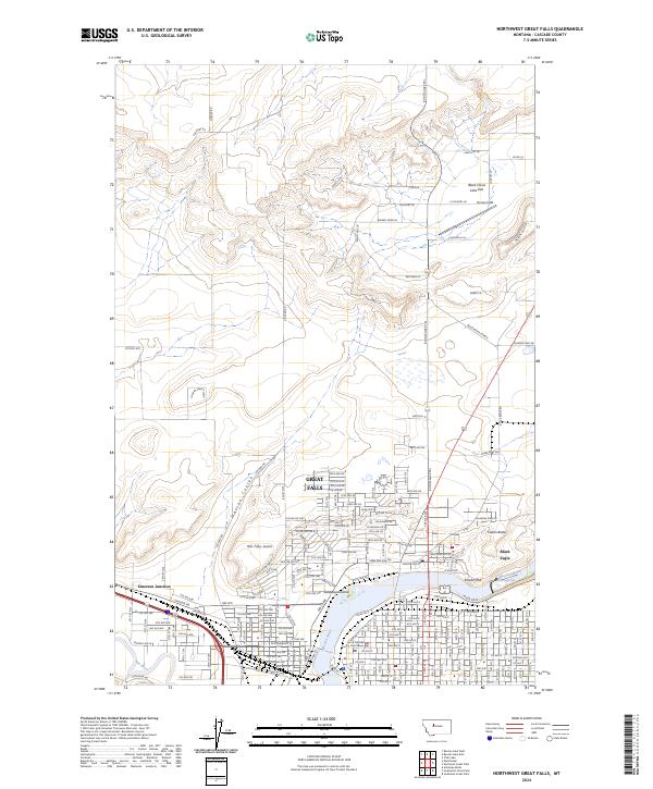
2024 Map of Northwest Great Falls
USGS Topo · Published 2024About this map
The Missouri River and its confluence with the Sun River anchor this detailed study of the industrial and residential landscape of Great Falls. The map documents the city's growth across the historic Smelter Hill and toward the northern plains, where the Benton Lake National Wildlife Refuge begins to dominate the horizon. In the urban core, landmarks such as the County Courthouse and the various neighborhoods of Black Eagle are clearly delineated alongside the tracks of the BNSF Railway.
Find a feature on this map
95 named features on this map. Tap any name to fly to it.
Don’t see what you’re looking for? This feature index may not catch every label — zoom into the map to look around manually.
Map Details
Editions of this 2024 Northwest Great Falls Map
This is the sole edition of this map. No revisions or reprints were ever made.
Other maps of this area

1886 · Great Falls
USGS Topo · 1:250,000

1948 · Portage
USGS Topo · 1:62,500

1949 · Portage
USGS Topo · 1:62,500

1949 · Great Falls
USGS Topo · 1:62,500

1951 · Great Falls
USGS Topo · 1:62,500

1954 · Great Falls
USGS Topo · 1:250,000

1955 · Stockett
USGS Topo · 1:62,500

1955 · Gore Hill
USGS Topo · 1:62,500

1957 · Great Falls
USGS Topo · 1:250,000
1965 · Manchester
USGS Topo · 1:24,000