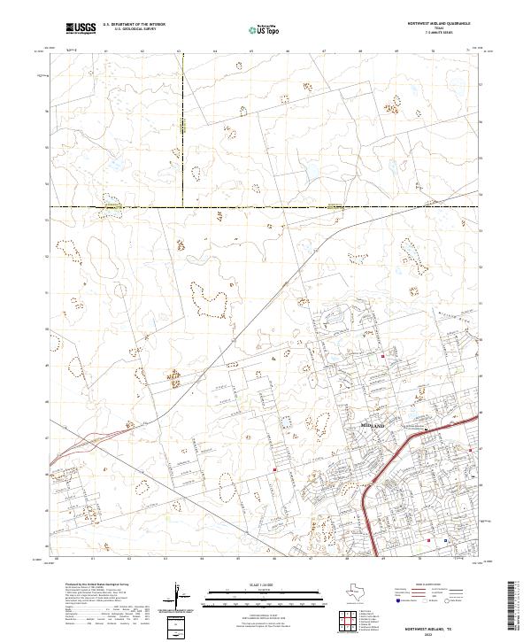
2022 Map of Northwest Midland
USGS Topo · Published 2022About this map
Midland expansion into the Permian Basin's arid landscape is captured here at a point of significant suburban and infrastructure development. The residential layout north of W Loop 250 N showcases a mix of established neighborhoods and newer growth, particularly around Green Tree Blvd and Tattenham Corner. The transition from urban density to rural land is marked by an extensive grid of county roads, such as W Co Rd 60 and W Co Rd 44, which stretch toward the county lines of Andrews and Martin. Local landmarks including the Saint Nicholas Episcopal Church Columbarium and the intermittent waterway of Midland Draw provide navigational and cultural anchors within this West Texas terrain, where the economy's reach into the surrounding flats is visible through the organized road network.
Find a feature on this map
62 named features on this map. Tap any name to fly to it.
Don’t see what you’re looking for? This feature index may not catch every label — zoom into the map to look around manually.
Map Details
Editions of this 2022 Northwest Midland Map
This is the sole edition of this map. No revisions or reprints were ever made.
Other maps of this area

1954 · Hobbs
USGS Topo · 1:250,000

1954 · Pecos
USGS Topo · 1:250,000

1957 · Pecos
USGS Topo · 1:250,000

1958 · Hobbs
USGS Topo · 1:250,000

1964 · Odessa NE
USGS Topo · 1:24,000

1965 · Southeast Midland
USGS Topo · 1:24,000

1965 · Southwest Midland
USGS Topo · 1:24,000

1965 · Northeast Midland
USGS Topo · 1:24,000

1966 · Mabee Ranch
USGS Topo · 1:24,000

1966 · North Curtis Ranch
USGS Topo · 1:24,000