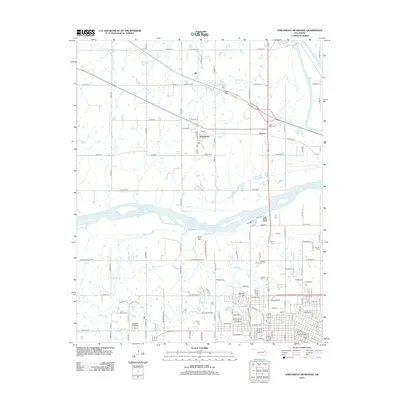
2012 Map of Northwest Muskogee
USGS Topo · Published 2012About this map
The Arkansas River and Verdigris River converge in this Oklahoma landscape, shaping the development and topography of the region north of Muskogee. The historic town of Tullahassee stands prominently near the junction of several rural roads and the Muskogee Tpke W, highlighting its importance in the local transport network. Further south, the terrain rises toward Agency Hill and Fern Mtn, where residential patterns begin to mesh with the natural elevations. This area is characterized by a significant concentration of local heritage sites, including numerous burial grounds like the Jacob Morey Cem and the Booker T Washington Cem. The presence of Honor Heights Lake and the winding Pecan Cr further define the water-rich geography of this quadrangle as it appeared in the early 21st century.
Find a feature on this map
62 named features on this map. Tap any name to fly to it.
Don’t see what you’re looking for? This feature index may not catch every label — zoom into the map to look around manually.
Map Details
Editions of this 2012 Northwest Muskogee Map
This is the sole edition of this map. No revisions or reprints were ever made.
Other maps of this area

1896 · Okmulgee
USGS Topo · 1:125,000

1900 · Okmulgee
USGS Topo · 1:125,000

1901 · Muscogee
USGS Topo · 1:125,000

1905 · Muscogee
USGS Topo · 1:125,000

1946 · Fort Smith
USGS Topo · 1:250,000

1948 · Keefeton
USGS Topo · 1:62,500

1948 · Wagoner
USGS Topo · 1:62,500

1950 · Keefeton
USGS Topo · 1:62,500

1950 · Wagoner
USGS Topo · 1:62,500
1963 · Red Bird
USGS Topo · 1:24,000