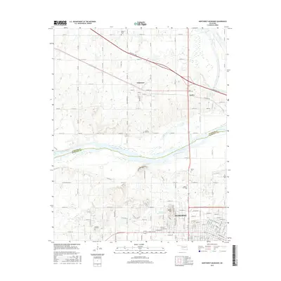
2016 Map of Northwest Muskogee
USGS Topo · Published 2016About this map
The Arkansas River and Verdigris River converge in this transition zone between the northern plains and the Cookson Hills, framing the historic settlement of Tullahassee. As one of Oklahoma's oldest towns founded by Muscogee (Creek) freedmen, the area maintains a distinct sense of place through its many community landmarks, including Mount Bethel Cem and the nearby Jacob Morey Cem near Anchor. The topography is defined by the sharp rise of Fern Mtn and Agency Hill, which overlook the northern reaches of Muskogee. This landscape is heavily tied to the movement of water and travelers, where the modern Muskogee Tpke cuts across older sections of the county. In the southern portion of the map, the development of the city is evident near Honor Heights Lake, while numerous burial sites like Booker T Washington Cem and Agency Cem offer significant touchpoints for family historians and researchers tracing the heritage of this river-front region.
Find a feature on this map
69 named features on this map. Tap any name to fly to it.
Don’t see what you’re looking for? This feature index may not catch every label — zoom into the map to look around manually.
Map Details
Editions of this 2016 Northwest Muskogee Map
This is the sole edition of this map. No revisions or reprints were ever made.
Other maps of this area

1896 · Okmulgee
USGS Topo · 1:125,000

1900 · Okmulgee
USGS Topo · 1:125,000

1901 · Muscogee
USGS Topo · 1:125,000

1905 · Muscogee
USGS Topo · 1:125,000

1946 · Fort Smith
USGS Topo · 1:250,000

1948 · Keefeton
USGS Topo · 1:62,500

1948 · Wagoner
USGS Topo · 1:62,500

1950 · Keefeton
USGS Topo · 1:62,500

1950 · Wagoner
USGS Topo · 1:62,500
1963 · Red Bird
USGS Topo · 1:24,000