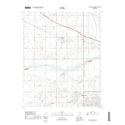
2019 Map of Northwest Muskogee
USGS Topo · Published 2019About this map
Tullahassee and the northern reaches of Muskogee define this landscape where the Arkansas River and Verdigris River converge. The topography is dominated by Agency Hill and Fern Mountain, creating a natural gateway between the historic creek systems of Pecan Creek and Big Creek. This 2019 survey captures the developed edge of the city transitioning into the rural township lines of t16n r17e and T16n R18e.
Find a feature on this map
77 named features on this map. Tap any name to fly to it.
Don’t see what you’re looking for? This feature index may not catch every label — zoom into the map to look around manually.
Map Details
Editions of this 2019 Northwest Muskogee Map
This is the sole edition of this map. No revisions or reprints were ever made.
Other maps of this area

1896 · Okmulgee
USGS Topo · 1:125,000

1900 · Okmulgee
USGS Topo · 1:125,000

1901 · Muscogee
USGS Topo · 1:125,000

1905 · Muscogee
USGS Topo · 1:125,000

1946 · Fort Smith
USGS Topo · 1:250,000

1948 · Keefeton
USGS Topo · 1:62,500

1948 · Wagoner
USGS Topo · 1:62,500

1950 · Keefeton
USGS Topo · 1:62,500

1950 · Wagoner
USGS Topo · 1:62,500
1963 · Red Bird
USGS Topo · 1:24,000