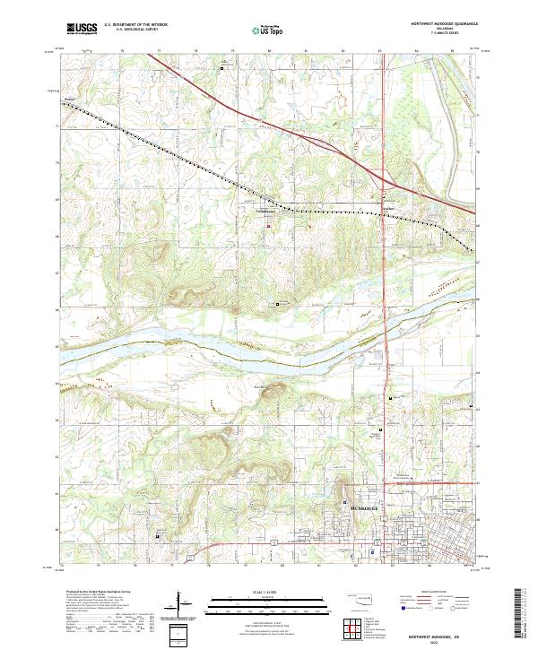
2022 Map of Northwest Muskogee
USGS Topo · Published 2022About this map
Tullahassee and the northern outskirts of Muskogee define this landscape where the Arkansas River and Verdigris River converge. The terrain is marked by significant elevations like Fern Mtn and Agency Hill, which overlook a region dense with local history and genealogical markers. Numerous burial grounds, including Booker T Washington Cem and Mount Bethel Cem, are scattered throughout the rural and suburban interface, providing essential data for family researchers. The map also captures the campus of Northeastern State University and developed areas such as Honor Heights Lake. This modern survey reveals the transition from the historic agriculture and transportation corridors of the river valley to the expanding residential grid of the county seat, documenting the enduring footprint of settlements like Porter and Anchor alongside the contemporary infrastructure of Wagoner and Muskogee counties.
Find a feature on this map
74 named features on this map. Tap any name to fly to it.
Don’t see what you’re looking for? This feature index may not catch every label — zoom into the map to look around manually.
Map Details
Editions of this 2022 Northwest Muskogee Map
This is the sole edition of this map. No revisions or reprints were ever made.
Other maps of this area

1896 · Okmulgee
USGS Topo · 1:125,000

1900 · Okmulgee
USGS Topo · 1:125,000

1901 · Muscogee
USGS Topo · 1:125,000

1905 · Muscogee
USGS Topo · 1:125,000

1946 · Fort Smith
USGS Topo · 1:250,000

1948 · Keefeton
USGS Topo · 1:62,500

1948 · Wagoner
USGS Topo · 1:62,500

1950 · Keefeton
USGS Topo · 1:62,500

1950 · Wagoner
USGS Topo · 1:62,500
1963 · Red Bird
USGS Topo · 1:24,000