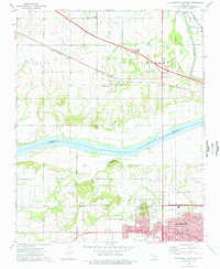
1974 Map of Northwest Muskogee
USGS Topo · Published 1978About this map
Tullahassee and the northern residential districts of Muskogee define this riverine landscape in the mid-1970s. The confluence of the Arkansas River and Verdigris River dominates the eastern edge of the quadrangle, where the Old Channel remains visible near the Pecan Park Recreation Area. This area serves as a critical transportation corridor, with the Muskogee Toll Road Turnpike slicing through the north and the Missouri - Kansas - Texas railroad tracking toward the urban center.
Find a feature on this map
63 named features on this map. Tap any name to fly to it.
Don’t see what you’re looking for? This feature index may not catch every label — zoom into the map to look around manually.
Map Details
Editions of this 1974 Northwest Muskogee Map
This is the sole edition of this map. No revisions or reprints were ever made.
Other maps of this area

1896 · Okmulgee
USGS Topo · 1:125,000

1900 · Okmulgee
USGS Topo · 1:125,000

1901 · Muscogee
USGS Topo · 1:125,000

1905 · Muscogee
USGS Topo · 1:125,000

1946 · Fort Smith
USGS Topo · 1:250,000

1948 · Keefeton
USGS Topo · 1:62,500

1948 · Wagoner
USGS Topo · 1:62,500

1950 · Keefeton
USGS Topo · 1:62,500

1950 · Wagoner
USGS Topo · 1:62,500
1963 · Red Bird
USGS Topo · 1:24,000