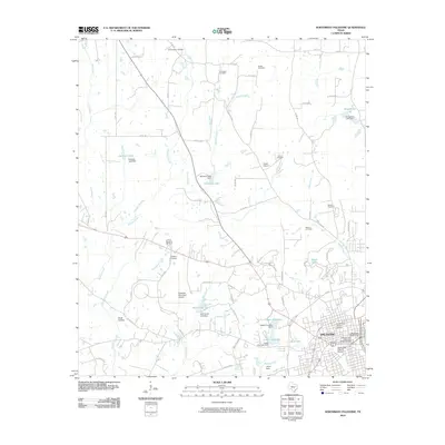
2010 Map of Northwest Palestine
USGS Topo · Published 2010About this map
The North Side Historic District and South Side Historic District anchor the city of Palestine in the southeastern corner of this map, highlighting the preservation of its urban core. The landscape is heavily defined by small-scale hydraulic infrastructure, featuring numerous reservoirs such as Wolf Creek Lake, Upper City Lake, and Broughton Lake, each supported by dedicated dams. This concentration of managed water resources suggests a history of careful municipal and agricultural water planning in this part of Anderson County.
Find a feature on this map
78 named features on this map. Tap any name to fly to it.
Don’t see what you’re looking for? This feature index may not catch every label — zoom into the map to look around manually.
Map Details
Editions of this 2010 Northwest Palestine Map
This is the sole edition of this map. No revisions or reprints were ever made.
Other maps of this area

1949 · Palestine
USGS Topo · 1:62,500

1949 · Tennessee Colony
USGS Topo · 1:62,500

1950 · Palestine
USGS Topo · 1:62,500

1950 · Tennessee Colony
USGS Topo · 1:62,500

1951 · Elkhart
USGS Topo · 1:62,500

1953 · Palestine
USGS Topo · 1:250,000

1957 · Palestine
USGS Topo · 1:250,000

1964 · Long Lake
USGS Topo · 1:24,000

1981 · Palestine
USGS Topo · 1:100,000
1982 · Northwest Palestine
USGS Topo · 1:24,000