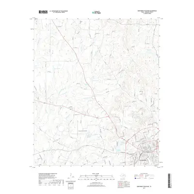
2019 Map of Northwest Palestine
USGS Topo · Published 2019About this map
The city of Palestine serves as the focal point for this survey, showcasing its northward expansion and the complex network of water resources that define the Anderson County landscape. The area is characterized by numerous small lakes and reservoirs, including Upper City Lake, Lower City Lake, and Davey Lake, which emphasize the importance of local water management. The terrain transitions into rural hills and drainages such as Keechie Creek and Sand Hollow to the northwest. For those tracing local history, the map provides an extensive record of community burial sites, with nearly a dozen cemeteries scattered across the landscape, from Fort Houston Cem in the north to the Land of Memory Cem near the Palestine Municipal Airport. The presence of Basset Cr and Wolf Cr illustrates the intricate watershed that supports both the urban center and the outlying settlements like Happy Acres Rd.
Find a feature on this map
148 named features on this map. Tap any name to fly to it.
Don’t see what you’re looking for? This feature index may not catch every label — zoom into the map to look around manually.
Map Details
Editions of this 2019 Northwest Palestine Map
This is the sole edition of this map. No revisions or reprints were ever made.
Other maps of this area

1949 · Palestine
USGS Topo · 1:62,500

1949 · Tennessee Colony
USGS Topo · 1:62,500

1950 · Palestine
USGS Topo · 1:62,500

1950 · Tennessee Colony
USGS Topo · 1:62,500

1951 · Elkhart
USGS Topo · 1:62,500

1953 · Palestine
USGS Topo · 1:250,000

1957 · Palestine
USGS Topo · 1:250,000

1964 · Long Lake
USGS Topo · 1:24,000

1981 · Palestine
USGS Topo · 1:100,000
1982 · Northwest Palestine
USGS Topo · 1:24,000