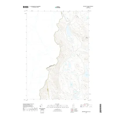
2021 Map of Northwest Pond
USGS Topo · Published 2021About this map
The international border between Canada and the United States defines this remote landscape where Franklin County and Oxford County meet. High elevations are anchored by Indian Stream Mtn, while the terrain below is defined by an intricate network of wetlands and small water bodies. This 2021 survey shows a region largely preserved in its natural state, utilized primarily through a series of primitive routes like Big Island Rd and the Around Pond Trl. The area contains several distinct ponds, including Little Northwest Pond, South Boundary Pond, and Big Island Pond, which suggest a topography shaped by glacial activity and slow-moving drainages like the Massachusetts Bog Stream. This map serves as a primary record of the modern Maine backcountry and its relationship with the Quebec border.
Find a feature on this map
16 named features on this map. Tap any name to fly to it.
Don’t see what you’re looking for? This feature index may not catch every label — zoom into the map to look around manually.
Map Details
Editions of this 2021 Northwest Pond Map
This is the sole edition of this map. No revisions or reprints were ever made.
Other maps of this area

1928 · Chain Lakes
USGS Topo · 1:48,000

1931 · Cupsuptic
USGS Topo · 1:48,000

1932 · Kennebago Lake
USGS Topo · 1:48,000

1932 · Arnold Pond
USGS Topo · 1:48,000

1932 · Chain Lakes
USGS Topo · 1:62,500

1934 · Cupsuptic
USGS Topo · 1:62,500

1935 · Kennebago Lake
USGS Topo · 1:62,500

1935 · Chain Lakes
USGS Topo · 1:62,500

1935 · Cupsuptic
USGS Topo · 1:62,500

1935 · Arnold Pond
USGS Topo · 1:62,500