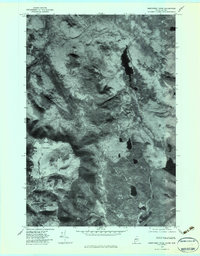
1977 Map of Northwest Pond
USGS Topo · Published 1983About this map
Mont Gosford anchors the western edge of this orthophotograph, representing the boundary landscape between Maine and Quebec in the late 1970s. This survey, derived from 1977 aerial imagery, illustrates a region defined by its hydrographic network rather than human settlements. The drainage patterns of the Kennebago River and the northern flow of Riviere Arnold dominate the terrain, reflecting the area's role as a watershed. Local water bodies such as Northwest Pond and Big Island Pond are prominent features alongside the expansive Massachusetts Bog. The absence of roads or structures in this quadrant highlights the remote character of the borderlands during this era, serving as a record of the undeveloped forest and wetland systems before modern changes. For those studying the history of the Kennebago headwaters, these clear aerial captures provide an exact layout of the Ruisseau Morin and its surrounding topography.
Find a feature on this map
7 named features on this map. Tap any name to fly to it.
Don’t see what you’re looking for? This feature index may not catch every label — zoom into the map to look around manually.
Map Details
Editions of this 1977 Northwest Pond Map
This is the sole edition of this map. No revisions or reprints were ever made.
Other maps of this area

1928 · Chain Lakes
USGS Topo · 1:48,000

1931 · Cupsuptic
USGS Topo · 1:48,000

1932 · Kennebago Lake
USGS Topo · 1:48,000

1932 · Arnold Pond
USGS Topo · 1:48,000

1932 · Chain Lakes
USGS Topo · 1:62,500

1934 · Cupsuptic
USGS Topo · 1:62,500

1935 · Kennebago Lake
USGS Topo · 1:62,500

1935 · Chain Lakes
USGS Topo · 1:62,500

1935 · Cupsuptic
USGS Topo · 1:62,500

1935 · Arnold Pond
USGS Topo · 1:62,500