Loading...
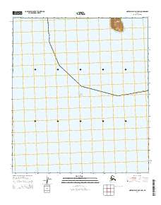
Loading map...2014 Map of Norton Bay B-5 OE S SW
USGS Topo · Published 2014About this map
Besboro Island rises sharply from the eastern reaches of Norton Sound in this 2014 geospatial study of the Norton Bay region. This maritime landscape is defined by the open waters of the sound and the administrative boundary of the Nome Census Area, which cuts a diagonal path across the sea floor within the survey. The island itself is the sole landmass present, featuring steep coastal bluffs that reach an elevation over 700 feet within a very small footprint.
Find a feature on this map
4 named features on this map. Tap any name to fly to it.
Don’t see what you’re looking for? This feature index may not catch every label — zoom into the map to look around manually.
Map Details
Date Portrayed2014
Date Published2014
PublisherU.S. Geological Survey
Map TypeTopographic
Scale1:25,000
Physical Dimensions24 x 29 inches
Editions of this 2014 Norton Bay B-5 OE S SW Map
This is the sole edition of this map. No revisions or reprints were ever made.
Other maps of this area






Featured Places
Source Details
SourceU.S. Geological Survey
CopyrightPublic Domain