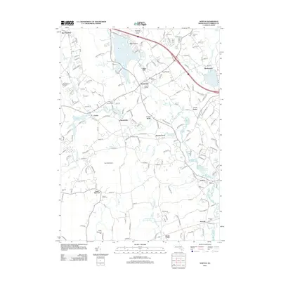
2012 Map of Norton
USGS Topo · Published 2012About this map
Norton serves as the central hub of this Bristol County landscape, defined by the prominent campus of Wheaton College and a complex network of waterways. The Norton Reservoir and Winnecunnet Pond dominate the northern and eastern sections, while the Wading River, Rumford River, and Canoe River converge toward the Three Mile River in the south. This modern survey illustrates the persistent industrial and residential nodes at Barrowsville, Chartley, and the Copper Works district, reflecting centuries of water-powered development. Genealogists will find several burial grounds documented, including Norton Center Cem and the Saint Francis Cem. The terrain is punctuated by Hemlock Island and Great Meadow Hill, while the Mansfield Municipal Airport marks the northern border, showing the integration of modern infrastructure with the historic mill-town settlement patterns of Centre Mills and East Norton.
Find a feature on this map
196 named features on this map. Tap any name to fly to it.
Don’t see what you’re looking for? This feature index may not catch every label — zoom into the map to look around manually.
Map Details
Editions of this 2012 Norton Map
This is the sole edition of this map. No revisions or reprints were ever made.
Other maps of this area

1885 · Taunton
USGS Topo · 1:62,500

1886 · Dedham
USGS Topo · 1:62,500

1887 · Franklin
USGS Topo · 1:62,500

1887 · Providence
USGS Topo · 1:62,500

1888 · Taunton
USGS Topo · 1:62,500

1889 · Providence
USGS Topo · 1:62,500

1889 · Franklin
USGS Topo · 1:62,500

1893 · Taunton
USGS Topo · 1:62,500

1893 · Franklin
USGS Topo · 1:62,500

1894 · Dedham
USGS Topo · 1:62,500