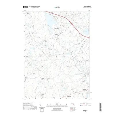
2018 Map of Norton
USGS Topo · Published 2018About this map
Wheaton College serves as a central landmark in this Bristol County landscape, surrounded by the historic villages of Norton Center, East Norton, and Centre Mills. The geography is defined by a complex network of waterways, including the Rumford River feeding into Norton Reservoir and the Wading River winding toward Chartley. Industrial and transit history is evident at Copper Works and Cranes Station, while the southern reaches of the map show the transition into North Rehoboth and the western edges of Taunton. Large natural features like Hemlock Swamp and Great Meadow Hill break up the residential and academic corridors, providing a sense of the original wetland and woodland character of southeastern Massachusetts. Genealogists will find numerous small burial grounds such as Babbit Cem, Newcomb Cem, and Stevens Corner Cem situated near early crossroads and family-named landmarks.
Find a feature on this map
167 named features on this map. Tap any name to fly to it.
Don’t see what you’re looking for? This feature index may not catch every label — zoom into the map to look around manually.
Map Details
Editions of this 2018 Norton Map
This is the sole edition of this map. No revisions or reprints were ever made.
Other maps of this area

1885 · Taunton
USGS Topo · 1:62,500

1886 · Dedham
USGS Topo · 1:62,500

1887 · Franklin
USGS Topo · 1:62,500

1887 · Providence
USGS Topo · 1:62,500

1888 · Taunton
USGS Topo · 1:62,500

1889 · Providence
USGS Topo · 1:62,500

1889 · Franklin
USGS Topo · 1:62,500

1893 · Taunton
USGS Topo · 1:62,500

1893 · Franklin
USGS Topo · 1:62,500

1894 · Dedham
USGS Topo · 1:62,500