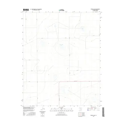
2016 Map of Norton Lake
USGS Topo · Published 2016About this map
Norton Lake and Red Windmill Lake serve as the primary landmarks in this high-plains landscape of the Texas Panhandle. The terrain is defined by its agricultural grid, where a network of county roads like Co Rd 23 and Co Rd R divide the open country into large, surveyed sections typical of the Llano Estacado. The presence of these named basins suggests important drainage points in an otherwise arid region where water features often dictate the placement of ranches and infrastructure. Along the southern edge, Ranch Rd 1412 provides the principal thoroughfare, connecting these remote properties to the broader region of Deaf Smith County. This topographic study reflects the modern rural character of the area, where historical property lines and access roads have remained largely unchanged over decades of cattle ranching and dry-land farming.
Find a feature on this map
11 named features on this map. Tap any name to fly to it.
Don’t see what you’re looking for? This feature index may not catch every label — zoom into the map to look around manually.
Map Details
Editions of this 2016 Norton Lake Map
This is the sole edition of this map. No revisions or reprints were ever made.
Other maps of this area

1954 · Tucumcari
USGS Topo · 1:250,000

1954 · Clovis
USGS Topo · 1:250,000

1958 · Clovis
USGS Topo · 1:250,000

1958 · Tucumcari
USGS Topo · 1:250,000

1966 · Moser Ranch
USGS Topo · 1:24,000

1966 · Boise
USGS Topo · 1:24,000

1966 · Simms NW
USGS Topo · 1:24,000

1966 · Simms
USGS Topo · 1:24,000

1966 · Sand Point
USGS Topo · 1:24,000

1966 · Norton Lake
USGS Topo · 1:24,000