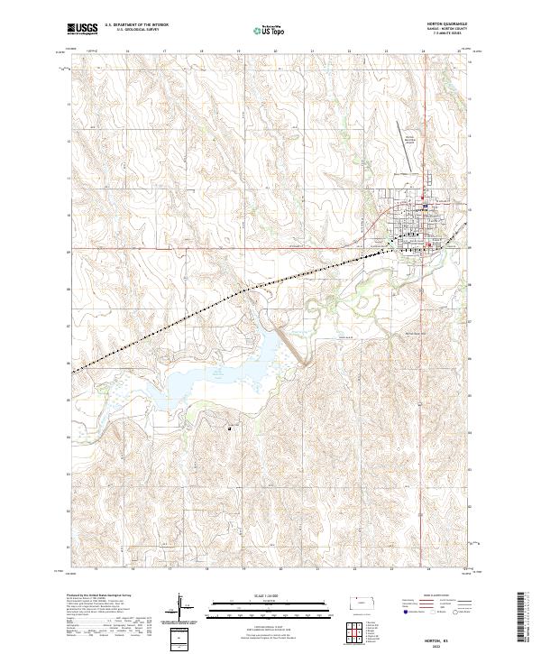
2022 Map of Norton
USGS Topo · Published 2022About this map
Norton serves as the focal point of this Northwest Kansas landscape, organized around the Norton County Court House and a grid of residential streets including W Holme St and W Main St. To the west, the landscape is defined by the significant waters of Keith Sebelius Lake, a reservoir formed by damming Prairie Dog Cr. The surrounding terrain transitions from the developed town center to the undulating uplands of the High Plains.
Find a feature on this map
31 named features on this map. Tap any name to fly to it.
Don’t see what you’re looking for? This feature index may not catch every label — zoom into the map to look around manually.
Map Details
Editions of this 2022 Norton Map
This is the sole edition of this map. No revisions or reprints were ever made.
Other maps of this area

1893 · Norton
USGS Topo · 1:125,000

1951 · Norton
USGS Topo · 1:62,500

1951 · Norcatur
USGS Topo · 1:62,500

1954 · Goodland
USGS Topo · 1:250,000

1955 · Beloit
USGS Topo · 1:250,000

1956 · Goodland
USGS Topo · 1:250,000

1957 · Goodland
USGS Topo · 1:250,000

1959 · Beloit
USGS Topo · 1:250,000
1965 · Norton NW
USGS Topo · 1:24,000
1965 · Devizes
USGS Topo · 1:24,000