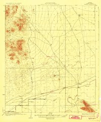
1929 Map of Norton
USGS Topo · Published 1929About this map
The Southern Pacific railroad corridor defines this desert landscape, linking the small railroad siding of Tyson to the settlement at Norton. Surveyed in the mid-1920s, the map reveals a reliant water infrastructure essential for desert survival, featuring family-named locations like Mesquite Jim Well and Terry Ranch. These points of habitation are flanked by the high elevations of the Castle Dome Range to the west and the Mohawk Mountains to the southeast.
Find a feature on this map
17 named features on this map. Tap any name to fly to it.
Don’t see what you’re looking for? This feature index may not catch every label — zoom into the map to look around manually.
Map Details
Editions of this 1929 Norton Map
2 editions found
Other maps of this area

1926 · Wellton
USGS Topo · 1:62,500

1926 · Mohawk
USGS Topo · 1:62,500

1927 · Kim
USGS Topo · 1:62,500

1928 · Mohawk
USGS Topo · 1:62,500

1928 · Norton
USGS Topo · 1:62,500

1929 · Wellton
USGS Topo · 1:62,500

1929 · Norton
USGS Topo · 1:62,500

1930 · Stoval
USGS Topo · 1:62,500

1931 · Kim
USGS Topo · 1:62,500

1942 · Yuma
USGS Topo · 1:250,000