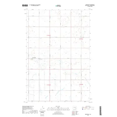
2018 Map of Nortonville
USGS Topo · Published 2018About this map
Nortonville anchors this survey of southeastern North Dakota, centered on the intersection of 2nd St and 80th Ave SE. The townsite sits within a landscape defined by prairie wetlands and the meandering course of Bone Hill Cr, which cuts through the southern sections of the quadrangle. As of 2018, the township is organized into a precise grid of rural roads, including Co Rd 35 and several numeric avenues. Local history and genealogy interest is concentrated near the settlement at the Nortonville Cem, while the surrounding terrain is marked by the distinct sections of Township 136 North and Township 135 North. The map reveals the extensive network of small lakes and marshes characteristic of the region's terminal moraine geology, illustrating how modern agriculture and natural drainage systems coexist.
Find a feature on this map
24 named features on this map. Tap any name to fly to it.
Don’t see what you’re looking for? This feature index may not catch every label — zoom into the map to look around manually.
Map Details
Editions of this 2018 Nortonville Map
This is the sole edition of this map. No revisions or reprints were ever made.
Other maps of this area

1896 · Jamestown
USGS Topo · 1:125,000

1896 · Edgeley
USGS Topo · 1:125,000

1925 · Edgeley
USGS Topo · 1:125,000

1953 · Jamestown
USGS Topo · 1:250,000

1953 · Montpelier
USGS Topo · 1:24,000

1953 · Montpelier NW
USGS Topo · 1:24,000

1953 · Adrian
USGS Topo · 1:24,000

1953 · Millarton
USGS Topo · 1:24,000

1953 · Nortonville
USGS Topo · 1:24,000

1953 · Jud SE
USGS Topo · 1:24,000