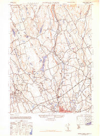
1943 Map of Norwalk North
USGS Topo · Published 1947About this map
Silvermine River and the Norwalk River dominate this Fairfield County landscape as it appeared during the 1940s. The map captures a critical period of infrastructure development, showing the winding path of the Merritt Parkway as it cuts through the southern reaches near Norwalk. Upstream, the terrain is defined by a series of water management projects, including the South Norwalk Reservoir, Grupes Reservoir, and Trinity Lake Reservoir, highlighting the area's role in supporting regional growth.
Find a feature on this map
66 named features on this map. Tap any name to fly to it.
Don’t see what you’re looking for? This feature index may not catch every label — zoom into the map to look around manually.
Map Details
Editions of this 1943 Norwalk North Map
2 editions found
Other maps of this area

1892 · Stamford
USGS Topo · 1:62,500

1892 · Danbury
USGS Topo · 1:62,500

1892 · Norwalk
USGS Topo · 1:62,500

1892 · Carmel
USGS Topo · 1:62,500

1893 · Carmel
USGS Topo · 1:62,500

1893 · Stamford
USGS Topo · 1:62,500

1893 · Norwalk
USGS Topo · 1:62,500

1894 · Carmel
USGS Topo · 1:62,500

1899 · Stamford
USGS Topo · 1:62,500

1915 · Danbury
USGS Topo · 1:62,500