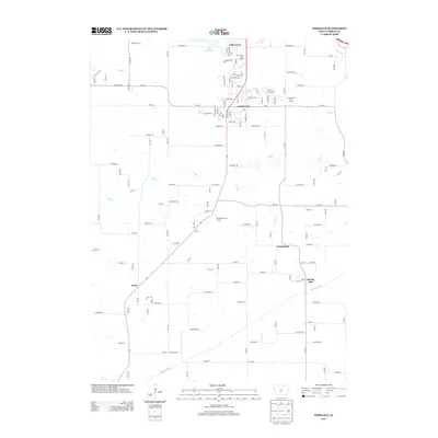
2013 Map of Norwalk
USGS Topo · Published 2013About this map
Norwalk serves as the primary hub of this 2013 survey, showing the residential expansion and suburban layout south of Des Moines. The landscape is defined by the winding course of the N River and Middle River, which cut through the agricultural surroundings. Significant recreational development is evident in the cluster of golf courses, including The Legacy Golf Course and Countryside Golf Course, indicating the area's transition toward a suburban commuter corridor. Smaller, established settlements like Spring Hill, Greenbush, and Prole anchor the southern and eastern portions of the map. In the north, the community of Lakewood is centered around the waters of Lake Colechester. The mapping of numerous local routes such as Beardsley Trl and Dubuque Trl provides a clear view of how traditional rural trails have been integrated into a modern street grid.
Find a feature on this map
64 named features on this map. Tap any name to fly to it.
Don’t see what you’re looking for? This feature index may not catch every label — zoom into the map to look around manually.
Map Details
Editions of this 2013 Norwalk Map
This is the sole edition of this map. No revisions or reprints were ever made.
Other maps of this area

1905 · Des Moines
USGS Topo · 1:62,500

1907 · Des Moines
USGS Topo · 1:62,500

1908 · Waukee
USGS Topo · 1:62,500

1931 · Indianola
USGS Topo · 1:62,500

1951 · St. Charles
USGS Topo · 1:62,500

1954 · Des Moines
USGS Topo · 1:250,000

1956 · Des Moines
USGS Topo · 1:250,000

1956 · Des Moines SW
USGS Topo · 1:24,000

1956 · Des Moines SE
USGS Topo · 1:24,000

1956 · Des Moines
USGS Topo · 1:62,500