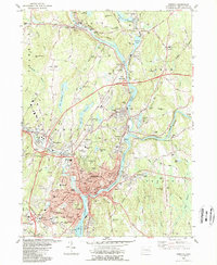
1983 Map of Norwich
USGS Topo · Published 1989About this map
The confluence of the Shetucket River, Yantic River, and Quinebaug River forms the Thames River at Norwich, creating a landscape defined by its industrial and maritime history. By the early 1980s, this area reflects a dense concentration of educational and medical institutions, including Mohegan Community College, Thames Valley State Tech School, and the Uncas on Thames Hospital. The textile heritage of the region is evident in the layout of mill villages like Baltic, Taftville, and Versailles, where worker housing and industrial ponds like Taftville Pond and Versailles Pond still frame the local geography.
Find a feature on this map
74 named features on this map. Tap any name to fly to it.
Don’t see what you’re looking for? This feature index may not catch every label — zoom into the map to look around manually.
Map Details
Editions of this 1983 Norwich Map
2 editions found
Other maps of this area

1889 · Stonington
USGS Topo · 1:62,500

1889 · Moosup
USGS Topo · 1:62,500

1892 · New London
USGS Topo · 1:62,500

1892 · Norwich
USGS Topo · 1:62,500

1893 · Moosup
USGS Topo · 1:62,500

1893 · Stonington
USGS Topo · 1:62,500

1893 · New London
USGS Topo · 1:62,500

1920 · Moosup
USGS Topo · 1:62,500

1921 · New London
USGS Topo · 1:62,500

1921 · Stonington
USGS Topo · 1:62,500