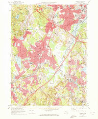
1970 Map of Norwood
USGS Topo · Published 1972About this map
The Neponset River corridor defines this industrial and suburban landscape during the early 1970s, where the expansion of Interstate 95 and U S 1 intersect a deeply rooted network of older villages. In Norwood, the central town core is dense with public infrastructure, including the Townhall, Armory, and multiple schools like the Winslow Sch. To the south, the landscape shifts toward the massive grounds of Sharon Memorial Park and the specialized collections of the Kendall Whaling Museum.
Find a feature on this map
113 named features on this map. Tap any name to fly to it.
Don’t see what you’re looking for? This feature index may not catch every label — zoom into the map to look around manually.
Map Details
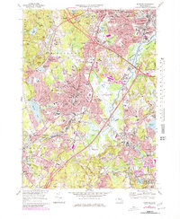
Editions of this 1970 Norwood Map
2 editions found
Other maps of this area

1886 · Dedham
USGS Topo · 1:62,500

1886 · Framingham
USGS Topo · 1:62,500

1887 · Franklin
USGS Topo · 1:62,500

1889 · Franklin
USGS Topo · 1:62,500

1889 · Framingham
USGS Topo · 1:62,500

1893 · Franklin
USGS Topo · 1:62,500

1893 · Boston
USGS Topo · 1:62,500

1894 · Dedham
USGS Topo · 1:62,500

1894 · Framingham
USGS Topo · 1:62,500

1903 · Boston
USGS Topo · 1:62,500