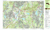
1985 Map of Norwood
USGS Topo · Published 1986About this map
The Neponset River winds through the heart of this Norfolk County landscape, defining the lowlands of Fowl Meadow and Purgatory Brook. By the mid-1980s, the region displays a dense network of suburban growth and industrial infrastructure, notably centered around the Norwood Memorial Airport and the critical rail intersection at Canton Junction. The northern reaches are dominated by the significant elevations of the Blue Hills Reservation, where peaks like Great Blue Hill and Chickatawbut Hill provide a stark contrast to the developed corridors of Norwood and Canton.
Find a feature on this map
102 named features on this map. Tap any name to fly to it.
Don’t see what you’re looking for? This feature index may not catch every label — zoom into the map to look around manually.
Map Details
Editions of this 1985 Norwood Map
2 editions found
Other maps of this area

1885 · Abington
USGS Topo · 1:62,500

1886 · Dedham
USGS Topo · 1:62,500

1886 · Framingham
USGS Topo · 1:62,500

1887 · Franklin
USGS Topo · 1:62,500

1888 · Abington
USGS Topo · 1:62,500

1889 · Franklin
USGS Topo · 1:62,500

1889 · Framingham
USGS Topo · 1:62,500

1892 · Boston Bay
USGS Topo · 1:62,500

1893 · Abington
USGS Topo · 1:62,500

1893 · Franklin
USGS Topo · 1:62,500