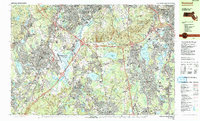
1985 Map of Norwood
USGS Topo · Published 1986About this map
The Blue Hills Reservation dominates the landscape of this mid-1980s Norfolk County survey, presenting a rugged skyline of peaks including Great Blue Hill, Hancock Hill, and Chickatawbut Hill. This significant greenbelt stands in contrast to the dense suburban development and industrial infrastructure that follows the Conrail line and the Neponset River corridor. The central portion of the map is anchored by the Norwood Memorial Airport, surrounded by a network of water bodies such as Willett Pond and Ponkapoag Pond.
Find a feature on this map
121 named features on this map. Tap any name to fly to it.
Don’t see what you’re looking for? This feature index may not catch every label — zoom into the map to look around manually.
Map Details
Editions of this 1985 Norwood Map
2 editions found
Other maps of this area

1885 · Abington
USGS Topo · 1:62,500

1886 · Dedham
USGS Topo · 1:62,500

1886 · Framingham
USGS Topo · 1:62,500

1887 · Franklin
USGS Topo · 1:62,500

1888 · Abington
USGS Topo · 1:62,500

1889 · Franklin
USGS Topo · 1:62,500

1889 · Framingham
USGS Topo · 1:62,500

1892 · Boston Bay
USGS Topo · 1:62,500

1893 · Abington
USGS Topo · 1:62,500

1893 · Franklin
USGS Topo · 1:62,500