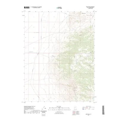
2023 Map of Notch Peak
USGS Topo · Published 2023About this map
Notch Peak dominates this section of the House Range in Millard County, rising sharply above the desert floor. The landscape is defined by its dramatic verticality, transitioning from the broad expanse of Tule Valley in the west to the high-elevation peaks and basins of the interior. Life in this arid environment centers on rare water sources like Painter Spring, while the physical geography is carved by significant drainages such as Marjum Canyon and Sawtooth Canyon.
Find a feature on this map
20 named features on this map. Tap any name to fly to it.
Don’t see what you’re looking for? This feature index may not catch every label — zoom into the map to look around manually.
Map Details
Editions of this 2023 Notch Peak Map
This is the sole edition of this map. No revisions or reprints were ever made.
Other maps of this area

1908 · Fish Springs
USGS Topo · 1:250,000

1910 · Fish Springs
USGS Topo · 1:250,000

1953 · Delta
USGS Topo · 1:250,000

1958 · Delta
USGS Topo · 1:250,000

1959 · Cowboy Pass
USGS Topo · 1:62,500

1960 · Notch Peak
USGS Topo · 1:62,500

1960 · Conger Mountain
USGS Topo · 1:62,500

1962 · Delta
USGS Topo · 1:250,000

1972 · Swasey Peak SW
USGS Topo · 1:24,000
1972 · Marjum Pass
USGS Topo · 1:24,000