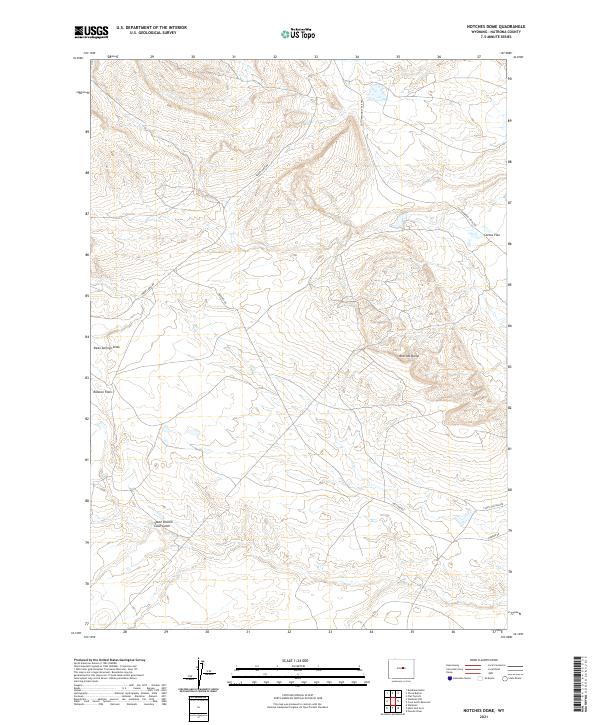
2021 Map of Notches Dome
USGS Topo · Published 2021About this map
Notches Dome anchors this high-elevation landscape in Natrona County, where the terrain transitions across several distinct plateaus and drainages. The map illustrates a network of range roads and stock trails that suggest a long-standing ranching presence, including the Cottonwood Stock Trl and the winding Baker Cabin Rd. These routes navigate the varied elevations between Ralston Flats and Cactus Flat, providing essential access through this part of the Wyoming interior.
Find a feature on this map
14 named features on this map. Tap any name to fly to it.
Don’t see what you’re looking for? This feature index may not catch every label — zoom into the map to look around manually.
Map Details
Editions of this 2021 Notches Dome Map
This is the sole edition of this map. No revisions or reprints were ever made.
Other maps of this area

1952 · Deadman Butte
USGS Topo · 1:24,000

1952 · Waltman NW
USGS Topo · 1:24,000

1952 · Waltman
USGS Topo · 1:24,000

1955 · Arminto
USGS Topo · 1:250,000

1958 · Arminto
USGS Topo · 1:250,000

1962 · Arminto
USGS Topo · 1:250,000
1968 · Notches Dome
USGS Topo · 1:24,000

1968 · Flat Top Hill
USGS Topo · 1:24,000
1968 · Powder River
USGS Topo · 1:24,000
1968 · Three Buttes
USGS Topo · 1:24,000