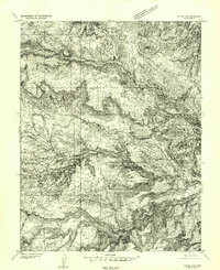
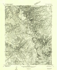
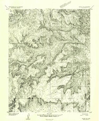
1952 Map of Notom
USGS Topo · Published 1963About this map
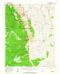
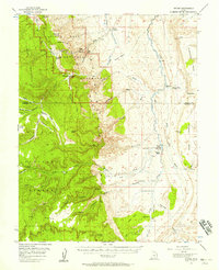
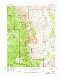
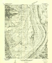
Capitol Reef National Monument and its dramatic geologic formations dominate this mid-century survey of the Utah backcountry. The map traces the formidable Waterpocket Fold and the colorful ridges of Capitol Reef, punctuated by landmarks like the Golden Throne and Eph Hanks Tower. Human history is etched into the landscape at the Pioneer Register and nearby Petroglyphs, while sparse desert settlements such as Notom and the Pleasant Creek Ranch mark the outposts of ranching life. To the south, the terrain climbs into the Dixie National Forest, where high plateaus like Buck Sheets overlook a complex network of drainages including Oak Creek and Tantalus Creek. The eastern half is defined by the Sandy Creek Benches and the winding Sandy Creek, illustrating the remote and difficult geography that shaped the early development of Wayne and Garfield counties.
Find a feature on this map
65 named features on this map. Tap any name to fly to it.
Don’t see what you’re looking for? This feature index may not catch every label — zoom into the map to look around manually.
Map Details
Editions of this 1952 Notom Map
3 editions found
Other maps of this area

1885 · San Rafael
USGS Topo · 1:250,000

1885 · Fish Lake
USGS Topo · 1:250,000

1886 · Escalante
USGS Topo · 1:250,000

1886 · Henry Mountains
USGS Topo · 1:250,000

1892 · Henry Mountains
USGS Topo · 1:250,000

1896 · Fish Lake
USGS Topo · 1:250,000
1952 · Notom 4 SE
USGS Topo · 1:24,000
1952 · Notom 2 SE
USGS Topo · 1:24,000
1952 · Notom 4 NW
USGS Topo · 1:24,000
1952 · Notom 4 SW
USGS Topo · 1:24,000