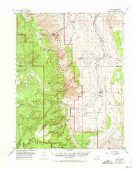
1952 Map of Notom
USGS Topo · Published 1973About this map
Capitol Reef National Monument dominates this mid-century landscape, revealing a remote region of the Colorado Plateau defined by water and rock. Before the monument's later expansion, this 1952 survey documents the isolation of Notom, where a few scattered outposts like Pleasant Creek Ranch and Sandy Ranch represent the sparse human footprint in a labyrinth of washes and mesas. The map details the complex drainage systems of Pleasant Creek, Sandy Creek, and Tantalus Creek, which carved the dramatic features of the Waterpocket Fold.
Find a feature on this map
65 named features on this map. Tap any name to fly to it.
Don’t see what you’re looking for? This feature index may not catch every label — zoom into the map to look around manually.
Map Details
Editions of this 1952 Notom Map
3 editions found

Other maps of this area

1885 · San Rafael
USGS Topo · 1:250,000

1885 · Fish Lake
USGS Topo · 1:250,000

1886 · Escalante
USGS Topo · 1:250,000

1886 · Henry Mountains
USGS Topo · 1:250,000

1892 · Henry Mountains
USGS Topo · 1:250,000

1896 · Fish Lake
USGS Topo · 1:250,000

1952 · Notom 4 SE
USGS Topo · 1:24,000

1952 · Notom 2 SE
USGS Topo · 1:24,000

1952 · Notom 4 NW
USGS Topo · 1:24,000

1952 · Notom 4 SW
USGS Topo · 1:24,000