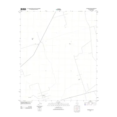
2012 Map of Notrees NW
USGS Topo · Published 2012About this map
Industrial energy production and shifting desert sands define this corner of the Permian Basin in the early 21st century. The Keystone Southeast Oil Field and Circle Oil Field dominate the southern landscape, indicating the intensive petroleum extraction that has shaped the local economy and infrastructure for decades. These fields are connected by a network of service roads and the state-maintained FM-874, which cuts across the terrain toward the northwest. Contrast is found in the natural geography of the Kermit Sand Hills, a significant dune system that creates a distinct environmental boundary against the industrial development. Scattered infrastructure, such as the North Windmill, serves as a reminder of the region's ranching origins, providing essential water points in an otherwise arid and demanding West Texas environment.
Find a feature on this map
5 named features on this map. Tap any name to fly to it.
Don’t see what you’re looking for? This feature index may not catch every label — zoom into the map to look around manually.
Map Details
Editions of this 2012 Notrees NW Map
This is the sole edition of this map. No revisions or reprints were ever made.
Other maps of this area

1954 · Hobbs
USGS Topo · 1:250,000

1954 · Pecos
USGS Topo · 1:250,000

1957 · Pecos
USGS Topo · 1:250,000

1958 · Hobbs
USGS Topo · 1:250,000

1969 · Jal SE
USGS Topo · 1:24,000

1970 · Vesrue
USGS Topo · 1:24,000

1970 · Kermit
USGS Topo · 1:24,000

1971 · Notrees
USGS Topo · 1:24,000

1971 · Notrees NW
USGS Topo · 1:24,000

1971 · Bedford Ranch
USGS Topo · 1:24,000