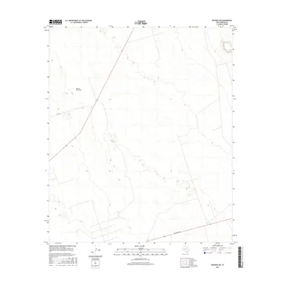
2016 Map of Notrees NW
USGS Topo · Published 2016About this map
Kermit Sand Hills dominate this portion of the West Texas landscape in Winkler County, characterized by a shifting terrain of sand dunes and arid basins. This 2016 survey captures a largely undeveloped expanse where the natural topography remains the primary feature, intersected only by a few significant transportation routes. The arrival of modern infrastructure is marked by the presence of Jim Sharp Blvd in the southern section and the path of N FM 874 cutting through the northwestern corner. This map serves as a clear record of the physical geography of the Permian Basin region, highlighting the minimal human footprint in an area defined by its environmental conditions and specialized road network.
Find a feature on this map
3 named features on this map. Tap any name to fly to it.
Don’t see what you’re looking for? This feature index may not catch every label — zoom into the map to look around manually.
Map Details
Editions of this 2016 Notrees NW Map
This is the sole edition of this map. No revisions or reprints were ever made.
Other maps of this area

1954 · Hobbs
USGS Topo · 1:250,000

1954 · Pecos
USGS Topo · 1:250,000

1957 · Pecos
USGS Topo · 1:250,000

1958 · Hobbs
USGS Topo · 1:250,000

1969 · Jal SE
USGS Topo · 1:24,000

1970 · Vesrue
USGS Topo · 1:24,000

1970 · Kermit
USGS Topo · 1:24,000

1971 · Notrees
USGS Topo · 1:24,000

1971 · Notrees NW
USGS Topo · 1:24,000

1971 · Bedford Ranch
USGS Topo · 1:24,000