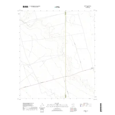
2019 Map of Notrees
USGS Topo · Published 2019About this map
Notrees anchors the eastern edge of this landscape where the Permian Basin terrain begins its transition across the Winkler Co Ector Co line. The settlement, which evolved to support the local oil and gas industry, is centered around a Po and is intersected by regional thoroughfares such as Jim Sharp Blvd. The map reveals a land defined by industrial infrastructure and accessibility, with a network of routes like N Climarex Rd and Winkler Co Rd 307 cutting through the sparse high plains. Contours indicate the subtle elevation changes of the Llano Estacado, providing a look at how energy development has shaped the modern layout of this West Texas region.
Find a feature on this map
7 named features on this map. Tap any name to fly to it.
Don’t see what you’re looking for? This feature index may not catch every label — zoom into the map to look around manually.
Map Details
Editions of this 2019 Notrees Map
This is the sole edition of this map. No revisions or reprints were ever made.
Other maps of this area

1954 · Hobbs
USGS Topo · 1:250,000

1954 · Pecos
USGS Topo · 1:250,000

1957 · Pecos
USGS Topo · 1:250,000

1958 · Hobbs
USGS Topo · 1:250,000

1964 · Turnbaugh Corner
USGS Topo · 1:24,000

1964 · Red Lakes
USGS Topo · 1:24,000

1968 · Coyote Corner
USGS Topo · 1:24,000

1971 · Notrees
USGS Topo · 1:24,000

1971 · Notrees NW
USGS Topo · 1:24,000

1971 · Bedford Ranch
USGS Topo · 1:24,000