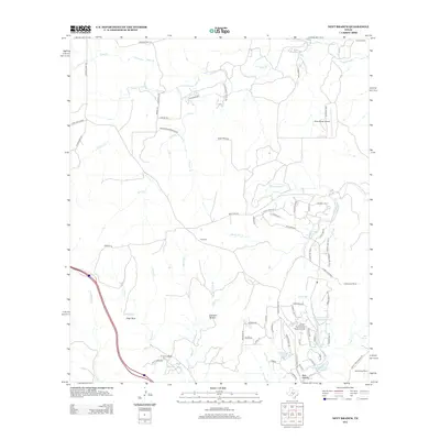
2012 Map of Nott Branch
USGS Topo · Published 2012About this map
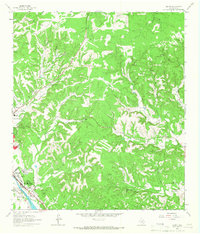
Peril Cem stands as a quiet genealogical anchor in this landscape of Hill Country ranching and private aviation. The map reveals a transition from traditional livestock operations like Circle D Ranch and Cottonwood Ranch toward residential ranch communities, evidenced by the clustered street names around the Tierra Linda Ranch Airport. This development is particularly visible in the southeastern quadrant, where a network of roads like Blue Sage Loop and Spanish Oak Trl N surrounds the Tierra Linda Upper Reservoir. The drainage patterns of Nott Br and White Oak Cr dictate the local geography, leading toward distinctive landmarks such as Pillar Rock and the low-lying Johnson Bottom. Aviation remains a key feature of the modern era here, with the Silver Wings Airport positioned to the north.
Find a feature on this map
78 named features on this map. Tap any name to fly to it.
Don’t see what you’re looking for? This feature index may not catch every label — zoom into the map to look around manually.
Map Details
Editions of this 2012 Nott Branch Map
This is the sole edition of this map. No revisions or reprints were ever made.
Other maps of this area

1894 · Kerrville
USGS Topo · 1:125,000

1954 · Llano
USGS Topo · 1:250,000

1955 · Llano
USGS Topo · 1:250,000

1956 · Llano
USGS Topo · 1:250,000

1964 · Morris Ranch
USGS Topo · 1:24,000

1964 · Nott Branch
USGS Topo · 1:24,000
1964 · Kerrville
USGS Topo · 1:24,000
1964 · Mountain Home
USGS Topo · 1:24,000
1964 · Hunt
USGS Topo · 1:24,000
1964 · Legion
USGS Topo · 1:24,000