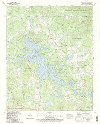
1988 Map of Nottely Dam
USGS Topo · Published 1988About this map
Nottely Lake dominates this Blue Ridge landscape, where the Nottely River was impounded by the Nottely Dam for power and recreation. The 1988 survey documents the intricate shoreline and the surrounding mountain ridges that define the border between Georgia and North Carolina. Small agricultural and residential nodes like Loudermilk, Ivylog, and Bethlehem are scattered among the foothills of the Nantahala National Forest and Chattahoochee National Forest.
Find a feature on this map
75 named features on this map. Tap any name to fly to it.
Don’t see what you’re looking for? This feature index may not catch every label — zoom into the map to look around manually.
Map Details
Editions of this 1988 Nottely Dam Map
2 editions found
Other maps of this area

1886 · Dahlonega
USGS Topo · 1:125,000

1888 · Ellijay
USGS Topo · 1:125,000

1892 · Dahlonega
USGS Topo · 1:125,000

1892 · Ellijay
USGS Topo · 1:125,000

1893 · Murphy
USGS Topo · 1:125,000

1896 · Dahlonega
USGS Topo · 1:125,000

1898 · Ellijay
USGS Topo · 1:125,000

1903 · Dahlonega
USGS Topo · 1:125,000

1911 · Ellijay
USGS Topo · 1:125,000

1914 · Murphy
USGS Topo · 1:125,000