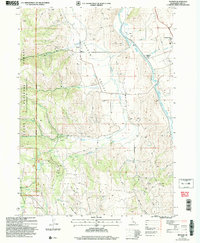
2005 Map of Nounan
USGS Topo · Published 2007About this map
Nounan Valley and the adjacent Bear Lake Valley dominate this landscape during the mid-2000s, showing a blend of agricultural life and managed wilderness. The Bear River winds through the eastern portion of the quadrangle, serving as a primary corridor for transportation and infrastructure, including the Georgetown (Siding) railroad point and a prominent Pipeline. For genealogists, the map identifies local burial sites such as Skinner Cem and Nounan Cem, while small settlements like Nounan and Georgetown anchor the valley floor.
Find a feature on this map
36 named features on this map. Tap any name to fly to it.
Don’t see what you’re looking for? This feature index may not catch every label — zoom into the map to look around manually.
Map Details
Editions of this 2005 Nounan Map
This is the sole edition of this map. No revisions or reprints were ever made.
Other maps of this area

1909 · Montpelier
USGS Topo · 1:125,000

1911 · Montpelier
USGS Topo · 1:125,000

1911 · Slug Creek
USGS Topo · 1:62,500

1915 · Preston
USGS Topo · 1:96,000

1918 · Preston
USGS Topo · 1:125,000

1948 · Soda Springs
USGS Topo · 1:62,500

1949 · Soda Springs
USGS Topo · 1:62,500

1955 · Preston
USGS Topo · 1:250,000

1958 · Preston
USGS Topo · 1:250,000

1962 · Preston
USGS Topo · 1:250,000