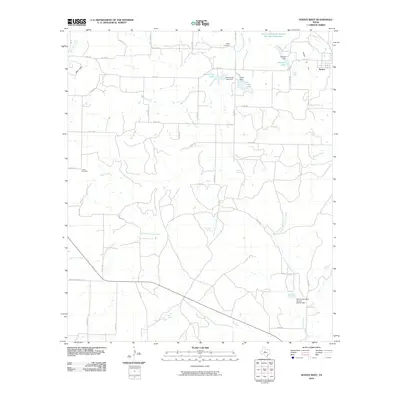
2010 Map of Novice West
USGS Topo · Published 2010About this map
Novice sits at the edge of a landscape defined by water management and rural crossings in Coleman County. This area of West Texas is marked by numerous man-made features designed to capture seasonal runoff, including the Soil Conservation Service Site 12e1 Reservoir and Novice City Lake. The terrain is drained by several branches of South Fork Jim Ned Creek and the North Prong Hords Creek, which cut through the ranch land. For genealogists, the map preserves the location of the Atoka Cemetery and Crews Cemetery, as well as several natural water sources such as Jim Ned Spring and Pecan Spring. A network of county roads and farm-to-market routes like FM 1770 connects these disparate points, reflecting a community built around livestock and resource conservation.
Find a feature on this map
50 named features on this map. Tap any name to fly to it.
Don’t see what you’re looking for? This feature index may not catch every label — zoom into the map to look around manually.
Map Details
Editions of this 2010 Novice West Map
This is the sole edition of this map. No revisions or reprints were ever made.
Other maps of this area

1890 · Abilene
USGS Topo · 1:125,000

1892 · Abilene
USGS Topo · 1:125,000

1892 · Ballinger
USGS Topo · 1:125,000

1954 · Brownwood
USGS Topo · 1:250,000

1954 · Abilene
USGS Topo · 1:250,000

1958 · Abilene
USGS Topo · 1:250,000

1967 · Talpa
USGS Topo · 1:24,000

1967 · Novice West
USGS Topo · 1:24,000
1967 · Novice East
USGS Topo · 1:24,000
1967 · Valera
USGS Topo · 1:24,000