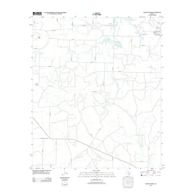
2013 Map of Novice West
USGS Topo · Published 2013About this map
The town of Novice sits in the northeastern corner of this Coleman County landscape, serving as a focal point for a region defined by its water resources and ranching history. Multiple reservoirs and natural catchments, including Novice City Lake, Coker Lake, and Daniels Lake, dot the terrain, illustrating the critical importance of water management in West Texas. The land is drained by a network of seasonal waterways such as S Fork Jim Ned Cr and Hords Cr, which wind through a landscape characterized by topographic breaks like Blue Gap.
Find a feature on this map
54 named features on this map. Tap any name to fly to it.
Don’t see what you’re looking for? This feature index may not catch every label — zoom into the map to look around manually.
Map Details
Editions of this 2013 Novice West Map
This is the sole edition of this map. No revisions or reprints were ever made.
Other maps of this area

1890 · Abilene
USGS Topo · 1:125,000

1892 · Abilene
USGS Topo · 1:125,000

1892 · Ballinger
USGS Topo · 1:125,000

1954 · Brownwood
USGS Topo · 1:250,000

1954 · Abilene
USGS Topo · 1:250,000

1958 · Abilene
USGS Topo · 1:250,000

1967 · Talpa
USGS Topo · 1:24,000

1967 · Novice West
USGS Topo · 1:24,000
1967 · Novice East
USGS Topo · 1:24,000
1967 · Valera
USGS Topo · 1:24,000