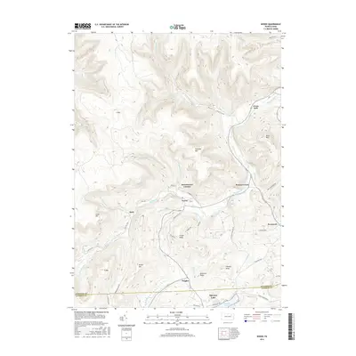
2016 Map of Noxen
USGS Topo · Published 2016About this map
Bowman Creek carves a deep valley through the high ridges of the Endless Mountains region, serving as the primary corridor for settlements like Noxen and Stull. This 2016 survey highlights the topographical complexity of the Wyoming and Luzerne County border, where steep landforms such as Schooley Mtn and Sorber Mtn define the residential patterns. While the northern half of the map is dominated by forest and narrow hollows, the southern edge transitions toward the recreational and residential hub of Harveys Lake. Named landmarks like Hettesheimer Corners and Evans Falls mark old crossroads and bridge points, while smaller water features such as Galkas Pond and the headwaters of Beaver Run drain the plateau near Ruggles. The map illustrates the persistent influence of terrain on local infrastructure, from the winding path of State Route 3002 to the isolated homesteads along Roote Hollow.
Find a feature on this map
56 named features on this map. Tap any name to fly to it.
Don’t see what you’re looking for? This feature index may not catch every label — zoom into the map to look around manually.
Map Details
Editions of this 2016 Noxen Map
This is the sole edition of this map. No revisions or reprints were ever made.
Other maps of this area

1891 · Harveys Lake
USGS Topo · 1:62,500

1893 · Harvey Lake
USGS Topo · 1:62,500

1893 · Pittston
USGS Topo · 1:62,500

1943 · Scranton
USGS Topo · 1:125,000

1945 · Meshoppen
USGS Topo · 1:62,500

1945 · Jenningsville
USGS Topo · 1:24,000

1945 · Meshoppen
USGS Topo · 1:24,000

1946 · Tunkhannock
USGS Topo · 1:62,500

1946 · Kingston
USGS Topo · 1:24,000

1946 · Dutch Mtn
USGS Topo · 1:24,000
Featured Places
- Dallas Township, PA
- Harveys Lake, PA
- Noxen Township, PA
- Forkston Township, PA
- Evans Falls, Monroe Township