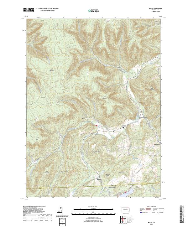
2023 Map of Noxen
USGS Topo · Published 2023About this map
Bowman Creek carves a deep valley through the northern sections of this terrain, serving as the central drainage for numerous tributaries like Hettesheimer Run and York Run. The settlement of Noxen sits at a narrow point in this valley, characterized by a tight cluster of streets including Tannery St, suggesting a legacy of local industry alongside the water. To the south, the landscape rises toward Schooley Mountain and Sorber Mountain, where the topography shifts from steep creek beds to the high ridges of Grassy Ridge.
Find a feature on this map
61 named features on this map. Tap any name to fly to it.
Don’t see what you’re looking for? This feature index may not catch every label — zoom into the map to look around manually.
Map Details
Editions of this 2023 Noxen Map
This is the sole edition of this map. No revisions or reprints were ever made.
Other maps of this area

1891 · Harveys Lake
USGS Topo · 1:62,500

1893 · Harvey Lake
USGS Topo · 1:62,500

1893 · Pittston
USGS Topo · 1:62,500

1943 · Scranton
USGS Topo · 1:125,000

1945 · Meshoppen
USGS Topo · 1:62,500

1945 · Jenningsville
USGS Topo · 1:24,000

1945 · Meshoppen
USGS Topo · 1:24,000

1946 · Tunkhannock
USGS Topo · 1:62,500

1946 · Kingston
USGS Topo · 1:24,000

1946 · Dutch Mtn
USGS Topo · 1:24,000