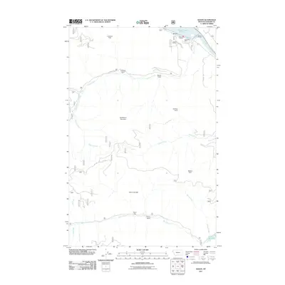
2011 Map of Noxon
USGS Topo · Published 2011About this map
Noxon sits at the northern edge of this landscape where the Clark Fork river is harnessed by the Cabinet Gorge Reservoir and the Noxon Reservoir. The settlement serves as a localized hub, containing the Noxon Post Office, the Noxon Rural Fire Dist, and the Noxon Cemetery. A network of Forest Service and local roads, such as Pilgrim Creek Rd and Klakken Rd, provides access to the high peaks and deep gulches of the surrounding terrain.
Find a feature on this map
33 named features on this map. Tap any name to fly to it.
Don’t see what you’re looking for? This feature index may not catch every label — zoom into the map to look around manually.
Map Details
Editions of this 2011 Noxon Map
This is the sole edition of this map. No revisions or reprints were ever made.
Other maps of this area

1920 · Libby
USGS Topo · 1:125,000

1930 · Libby
USGS Topo · 1:125,000

1932 · Libby
USGS Topo · 1:125,000

1932 · Trout Creek
USGS Topo · 1:125,000

1935 · Trout Creek
USGS Topo · 1:125,000

1936 · Trout Creek
USGS Topo · 1:125,000

1956 · Wallace
USGS Topo · 1:250,000

1957 · Kalispell
USGS Topo · 1:250,000

1960 · Kalispell
USGS Topo · 1:250,000

1960 · Wallace
USGS Topo · 1:250,000