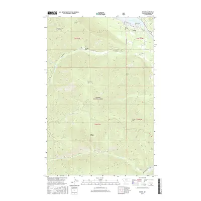
2017 Map of Noxon
USGS Topo · Published 2017About this map
Noxon serves as the primary settlement on this portion of the Kaniksu National Forest, situated along the northern banks of the Cabinet Gorge Reservoir. The landscape is dominated by the steep drainages and high summits of the Bitterroot Mountains, including Huckleberry Mtn, Loveland Peak, and Stevens Peak. Water management and transportation define the local geography, as seen in the wide expanse of the Clark Fork river as it transitions into reservoir pools. The Noxon Bridge and the Railroad Rd corridor provide vital crossings and transit routes through this complex terrain. Numerous gulches and creeks, such as Hemlock Gulch and Pilgrim Cr, cut through the forest, leading toward the Noxon Reservoir and Marten Creek Bay in the south. Local landmarks like the Noxon Cem and Old Trail Point offer points of reference for those tracing the community's footprint within the national forest boundaries.
Find a feature on this map
40 named features on this map. Tap any name to fly to it.
Don’t see what you’re looking for? This feature index may not catch every label — zoom into the map to look around manually.
Map Details
Editions of this 2017 Noxon Map
This is the sole edition of this map. No revisions or reprints were ever made.
Other maps of this area

1920 · Libby
USGS Topo · 1:125,000

1930 · Libby
USGS Topo · 1:125,000

1932 · Libby
USGS Topo · 1:125,000

1932 · Trout Creek
USGS Topo · 1:125,000

1935 · Trout Creek
USGS Topo · 1:125,000

1936 · Trout Creek
USGS Topo · 1:125,000

1956 · Wallace
USGS Topo · 1:250,000

1957 · Kalispell
USGS Topo · 1:250,000

1960 · Kalispell
USGS Topo · 1:250,000

1960 · Wallace
USGS Topo · 1:250,000