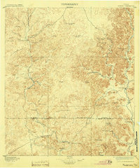
1896 Map of Nueces
USGS Topo · Published 1904About this map
The rugged canyonlands of the upper Nueces River watershed define this 1890s survey, where early ranching outposts are scattered across the Edwards Plateau. The map captures a frontier landscape centered on the confluence of the East Nueces River and West Nueces River, highlighting early settlements such as Barksdale and Vance. The territory is marked by essential water sources like Kickapoo Spring and Cherry Spring, which supported a network of family-operated holdings including Ford and Holliday Ranch and the Wheat and Luckys Ranch.
Find a feature on this map
81 named features on this map. Tap any name to fly to it.
Don’t see what you’re looking for? This feature index may not catch every label — zoom into the map to look around manually.
Map Details
Editions of this 1896 Nueces Map
4 editions found
Other maps of this area

1893 · Rock Springs
USGS Topo · 1:125,000

1893 · Nueces
USGS Topo · 1:125,000

1896 · Nueces
USGS Topo · 1:125,000

1896 · Brackett
USGS Topo · 1:125,000

1897 · Brackett
USGS Topo · 1:125,000

1898 · Uvalde
USGS Topo · 1:125,000

1899 · Uvalde
USGS Topo · 1:125,000

1938 · Turkey Mountain
USGS Topo · 1:48,000

1941 · Standart
USGS Topo · 1:62,500

1943 · Turkey Mountain
USGS Topo · 1:62,500