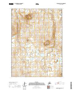
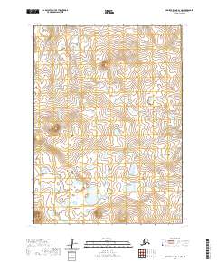
2020 Map of Nunivak Island A-4 NE
USGS Topo · Published 2020About this map
Ikathiwik Crater dominates the northern uplands of this landscape on Nunivak Island, illustrating the volcanic foundations of the Bering Sea coast. The terrain transitions from these elevated volcanic forms to a complex network of wetlands and small lakes in the south, characteristic of the island's drainage patterns. Kimijooksuk Butte stands as a prominent landmark in the east-central region, providing a significant vertical break in the otherwise undulating tundra. This 2020 survey by the U.S. Geological Survey documents the wilderness area within the Bethel Census Area, recording the precise topography and hydrography before any major environmental shifts. The map is primarily defined by its natural features, with no modern infrastructure or permanent settlements indicated, reflecting the preservation of the indigenous landscape.
Find a feature on this map
7 named features on this map. Tap any name to fly to it.
Don’t see what you’re looking for? This feature index may not catch every label — zoom into the map to look around manually.
Map Details
Editions of this 2020 Nunivak Island A-4 NE Map
This is the sole edition of this map. No revisions or reprints were ever made.
Other maps of this area

1951 · Nunivak Island
USGS Topo · 1:250,000

1952 · Nunivak Island A-4
USGS Topo · 1:63,360

1952 · Nunivak Island A-3
USGS Topo · 1:63,360
1952 · Nunivak Island B-3
USGS Topo · 1:63,360
1952 · Nunivak Island B-4
USGS Topo · 1:63,360

1954 · Nunivak Island
USGS Topo · 1:250,000

1958 · Nunivak Island
USGS Topo · 1:250,000

1964 · Nunivak Island
USGS Topo · 1:250,000
2020 · Nunivak Island A-3 SW
USGS Topo · 1:25,000
2020 · Nunivak Island A-3 NW
USGS Topo · 1:25,000